3D laser scanning is a non-contact reality-capture method. It records the visible geometry and spatial relationships of a property as dense digital data. That record can support insurance claims, construction defect investigations, premises liability matters, and property damage litigation.
This article covers how scanning works, what it preserves, how to build a defensible workflow, and what a scan cannot prove.
Key Takeaways
- A scan records visible conditions as a measurable spatial record, not just notes or flat photos.
- Timing, full coverage, retained originals, accurate metadata, and controlled sharing matter as much as the scanner.
- Supports claims work, but does not establish liability, causation, damages, authenticity, or admissibility.
- Vroomk turns physical spaces into shareable digital records for legal, insurance, and restoration teams.
What Is 3D Laser Scanning and How Does It Work?
3D laser scanning captures a physical space as a dense set of measured points. A scanner emits laser light, measures the reflected signal, and uses distance and angle to place each point in three-dimensional space. Millions of those points form a point cloud.
According to NIJ-funded guidelines, terrestrial scanners record X, Y, and Z positions plus intensity values. Ranging works by pulse time-of-flight or by phase difference between emitted and reflected waves.
LiDAR vs. 3D Laser Scanning
LiDAR (Light Detection and Ranging) is the distance-measurement method. 3D laser scanning is the broader workflow: capture, alignment, processing, and delivery. Scanning often uses LiDAR-based equipment, but the terms aren't interchangeable.
Common Outputs
- Point clouds as measured spatial datasets
- Colorized captures and 360-degree imagery
- Measurements and exported stills
- Interactive walkthroughs
- CAD or BIM models, when produced separately from the scan
The Field Process
- Define the scope and pick equipment.
- Place the scanner at multiple viewpoints with overlapping coverage.
- Register the scans into one coordinate system.
- Remove noise and check alignment.
- Export the right deliverables.

Even with a solid process, line of sight drives everything. Walls, furniture, debris, vehicles, and people create gaps, and concealed conditions stay concealed.
In a collapsed-ceiling room, a good capture covers the ceiling opening, flooring, wall finishes, fixtures, and debris placement before restoration changes the scene.
The scan records spatial conditions. Attorneys, adjusters, engineers, and contractors interpret them to assess scope, causation, responsibility, and damages.
How 3D Laser Scanning Preserves Property Conditions for Claims and Litigation
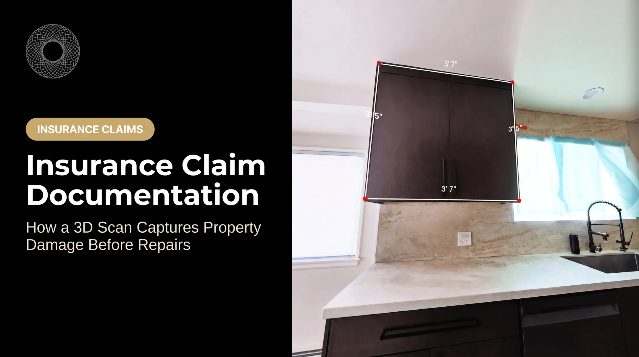
Photos and written descriptions struggle to convey room dimensions, elevation changes, distances, sightlines, and how damaged components relate to each other. A spatial record keeps those relationships intact, including cracks, water staining, displaced materials, unfinished work, openings, fixtures, access paths, and surrounding context.
A Before-and-After Timeline
- Before alteration: capture the property after the loss, inspection, or construction milestone.
- During intervention: capture demolition, drying, remediation, or repair progress.
- After work: record completed conditions, remaining defects, or disputed areas for comparison.
Measurements and navigation let stakeholders locate and discuss a disputed condition without everyone returning to the site.
Common Use Cases
- Insurance claims: remote review, scope discussions, and before-and-after comparisons among adjusters, restorers, owners, and experts.
- Construction defects: preserve components before they are covered, removed, or replaced.
- Premises liability: document layout, walking surfaces, obstructions, and surrounding environment.
- Contractor and owner disputes: a shared reference for progress, existing conditions, and disputed changes.
Court records show how this plays out. In Universal Underwriters Insurance Co. v. Dedicated Logistics, a fire case, an expert used scanning to document utility poles, power lines, and the exterior of a dealership in a filed expert report. The court found the methodology sufficiently reliable under Rule 702. That ruling concerned one expert's analysis, not scanning in general.
The Evidentiary Boundary
A scan is documentation, not a conclusion about fault. Under the Federal Rules of Evidence, authentication (Rules 901 and 902) is separate from hearsay and expert-reliability requirements. Admission is never guaranteed.
Preservation duties vary by state. Miller v. Lankow (Minn. 2011), for example, recognizes a duty when litigation is reasonably foreseeable, while allowing reasonable remediation if the other side gets notice and a fair chance to inspect.
Interactive platforms make that record usable off-site. Vroomk provides private shareable walkthrough links, in-scene measurements, and thousands of exportable stills. Counsel and technical professionals should still decide the evidence-preservation process.
The 3D Documentation Workflow for Claims and Litigation
Plan Before Capture
Define the job before anyone arrives on site:
- Incident, areas, and disputed conditions
- Intended users, expected repairs, and privacy controls
- Whether repeat captures will be needed
Record site context first:
- Property identity, date, and time
- Areas included and excluded, plus access limits
- Visible hazards, occupancy, and lighting or weather where relevant
Capture On Site
- Use multiple viewpoints to reduce occlusions across rooms, corridors, exteriors, and damaged areas.
- Note areas that couldn't be accessed, concealed conditions, and temporary objects or people.
- Coordinate with the owner, insurer, restorer, contractor, and counsel so preservation doesn't block safety or emergency work.
Process and Check Quality
- Register the scans and verify alignment
- Find gaps, remove noise, and confirm intended areas are present
- Log every processing and export step
Published VDOT guidance calls for registration error reports and comparison against validation points.
Manage the Evidence
- Keep native capture files separate from processed copies and presentation exports.
- Log file names, versions, dates, operators, equipment, software, storage locations, permissions, and transformations.
- Use controlled access and an audit trail where the platform supports one.
- Follow the retention requirements of the client, insurer, counsel, and jurisdiction.
NIST recommends hashing digital evidence near the point of collection, and the Scientific Working Group on Digital Evidence (SWGDE) calls for contemporaneous custody records.
Handoff Sequence
- Confirm what was captured and when so recipients know scope and timing.
- Preserve originals and metadata as the authoritative record.
- Identify gaps and limitations before anyone relies on the file.
- Pair the scan with photos, reports, invoices, contracts, plans, and witness accounts.
- Keep captured condition separate from later interpretation so the record stays neutral.

What a Litigation-Ready 3D Record Should Include
Metadata checklist:
- Property identifier, address, and site description
- Date, time, and purpose of capture
- Areas scanned and known access limits
- Operator, equipment, and software
- Control information, if used
Keep every deliverable layer:
- Original capture data and registered point cloud
- Color imagery and interactive walkthrough
- Measurement exports and annotations
- Processed versions
- Any CAD or BIM model derived from the scan
Quality assurance records:
- Registration checks and coverage review
- Known gaps
- Calibration records where available
- Description of any edits or filtering
Privacy: Limit access to authorized users under the engagement terms when scans include occupied homes, personal belongings, or confidential business areas.
A "how to read this record" summary should state what the scan shows, what it does not, how to interpret measurements, and which conclusions need an expert.
Before you capture: if litigation is reasonably anticipated, talk to counsel, insurers, and experts first. Preservation notices, privilege, retention, and discovery obligations can all shape what and how you capture.
When 3D Laser Scanning Helps, and Its Limits
Where It Helps Most
- Sites changing fast, such as a ceiling collapse before cleanup
- Large or complex properties
- Disputed dimensions or locations
- Work that will hide visible conditions, such as framing and MEP rough-ins before drywall
- Unsafe areas and cases with remote stakeholders
One Vroomk client reported a crew arriving within hours and a shared scan link two days later, before the insurer removed materials.
Complementary Methods
- Photos and video for close detail, labels, text, and color
- Notes, reports, drawings, invoices, and statements for chronology
- Moisture testing, thermal imaging, ground-penetrating radar, or destructive investigation for hidden conditions
Limitations to Disclose
Scanners can't see inside walls, beneath finishes, behind obstructions, or above closed ceilings. The National Park Service notes difficulty with dark or mirror-like materials such as glass, water, chrome, and polished finishes, and VDOT advises against scanning wet surfaces.
Accuracy depends on equipment, distance, surface, control, registration, technique, and processing. Check current manufacturer datasheets. Leica's RTC360 lists 1.9 mm at 10 m, for instance, under stated statistical conditions. Don't assume one universal figure.
Cost Drivers
These factors all move the price:
- Property size, complexity, and viewpoints
- Access, urgency, and repeat visits
- Outputs, processing, hosting, and modeling
Ask for a scope-based quote that itemizes field capture, processing, hosting, exports, modeling, travel, repeat scans, and rush delivery. Vroomk's spatial capture starts at $1.50 per square foot, with a $499 emergency add-on.

Frequently Asked Questions
How much does 3D laser scanning cost?
Cost depends on property size, complexity, access, scope, urgency, repeat visits, processing, and deliverables. Request a scope-based quote rather than relying on a universal price.
How accurate is 3D laser scanning?
Accuracy depends on the equipment, surface, distance, control, registration, operator, and processing. Review published specifications and define an accuracy standard for the project.
Do I need LiDAR for 3D laser scanning?
LiDAR is a common measurement method in scanning workflows, but the right equipment depends on the property, detail required, coverage, speed, and deliverables.
Is LiDAR the same as 3D laser scanning?
No. LiDAR measures distance with light. 3D laser scanning is the broader process of capturing, aligning, processing, and delivering spatial data.
What is 3D laser scanning used for?
Property-condition documentation, insurance claims, construction defect work, premises liability, restoration, as-built records, measurements, and dispute resolution.
What is 3D laser scanning?
It captures visible surfaces and spatial relationships as dense three-dimensional data that can be measured, shared, and converted into other digital deliverables.