Introduction
Construction claims turn on what existed at a specific moment, how a condition changed, and who was responsible before the site was repaired, covered, or altered. Once drywall closes or a damaged ceiling is hauled away, that moment is gone.
Most teams fall back on photographs, daily reports, emails, schedules, and memory. These records are often fragmented and rarely show where one condition sits relative to another. That gap matters: Arcadis's 2026 report puts the average U.S. construction dispute at $56 million and 12.16 months.
This article covers how walkable 3D scans create a shared, navigable record that strengthens claim preparation. They do not replace contracts, notices, expert analysis, or legal advice.
Key Takeaways
- Walkable 3D scans let authorized users revisit a site remotely instead of relying on isolated images.
- Scans preserve visible conditions before demolition, repair, concealment, or handover.
- Owners and contractors can use them for defect, delay, change order, damage, and progress disputes.
- Consistent capture, project-record ties, and preserved context make a scan strongest as evidence.
What Are Walkable 3D Scans?
A walkable 3D scan turns a property or jobsite into an interactive digital environment. Users move through it from different viewpoints in a browser, much like standing in the space.
Photos show what the photographer chose to frame. A conventional video follows one path. A walkable record keeps rooms, distances, and locations together, so reviewers can see where a condition sits and what surrounds it.

Common construction uses include:
- Baseline condition surveys before work starts
- Recurring progress documentation
- Concealed-work records (framing, MEP, rough-ins)
- Defect investigations
- Insurance and restoration claims
- As-built reference and handover documentation
The scan preserves and communicates evidence. It is not the goal in itself.
Key Advantages of Walkable 3D Scans for Construction Claims
Judge a scan by what it does for evidence quality, review speed, coordination, and risk control, not by how novel the technology is.
Owners, contractors, attorneys, adjusters, and experts each use the same record for their own side of a dispute, whether they are asserting a claim or responding to one.
Preserve Site Conditions Before They Change
A scan captured before demolition, remediation, repair, or closing walls preserves the visible state of finishes, equipment, openings, damage, and access routes.
Practical scenarios:
- Water damage documented before restoration begins
- Existing defects recorded before a remodel
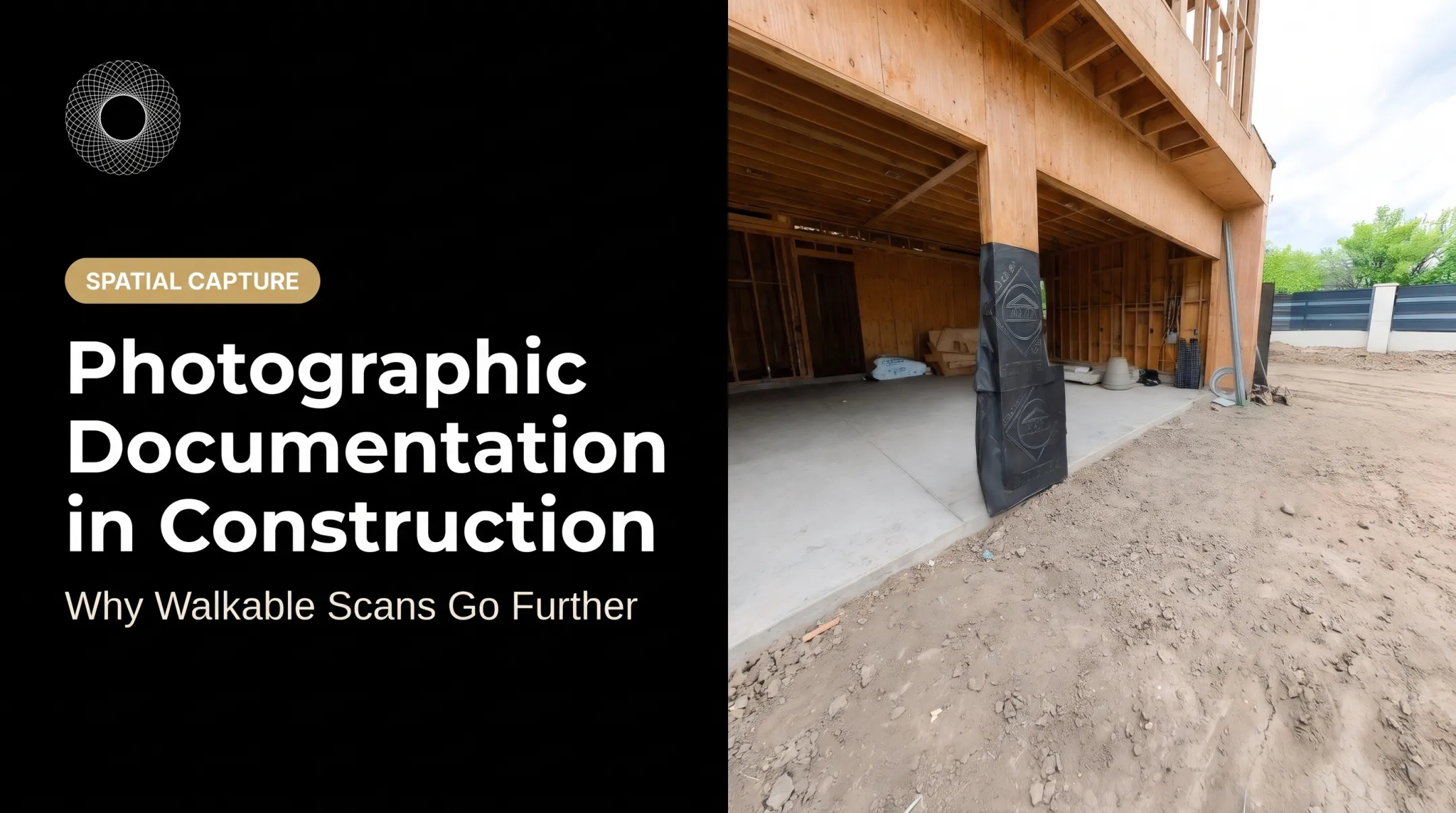
- Installed work captured before drywall closes access
Vroomk, for example, describes an emergency scan after a ceiling collapse that preserved evidence before the insurer removed damaged materials. A remodeling customer reported that a rough-in scan located wiring before anyone cut into finished walls.
Preservation is not proof of cause or responsibility. It fixes the condition; other evidence has to explain it.
Contemporaneous records also matter legally. The ABA Forum on Construction Law discusses repairs, demolition, and spoliation, and lists job records, as-builts, and progress documentation among the evidence in construction disputes. A condition record made at the time beats recollection years later.
Connect Physical Conditions to Causation, Scope, and Quantum
Spatial evidence helps teams locate an alleged defect or change, compare it with drawings and specifications, take supported measurements, and identify the affected work area.
A claim still needs more. AACE RP 120R-21 names contractual entitlement, causation, mitigation, responsibility, and quantification as the critical elements. A scan feeds those elements when combined with:
- Schedules and daily reports
- RFIs and change orders
- Cost records and notices
- Expert analysis
One restoration contractor, Dalworth Restoration, reports using a navigable pre-mitigation record to assess damage, scope work, and share a common record during claims. The vendor-reported case study says this reduced inquiries and disputes, but does not provide figures. A scan alone does not prove damages.

Create a Shared Record for Owners, Contractors, and Experts
Private walkthrough links let owners, subcontractors, insurers, attorneys, and experts review the same site without everyone returning to the property.
A shared reference reduces confusion about room locations, sequence, access, and completed work. Permissions and confidentiality controls still matter, so decide who gets access before sharing.
The practical payoff is faster claim triage, fewer repeat visits, clearer meetings, and more focused expert inspections. In a vendor-reported case, Knutson Construction credits Matterport with a 75% decrease in costly site visits. Treat that as one company's result, not a benchmark.
What Happens When Walkable 3D Scans Are Missing or Ignored
Without a spatial record, teams are left with incomplete photographs, inconsistent viewpoints, missing room context, and conflicting memories once a condition has been repaired.
The consequences stack up:
- Repeated site visits to re-establish basic facts
- Slower expert investigations while context is rebuilt
- Arguments over whether a condition ever existed
- Trouble tying a physical issue to a specific activity, instruction, or milestone
The PlanGrid and FMI survey attributes 48% of U.S. rework to inaccurate, inaccessible, or incompatible project data. That figure concerns project data broadly, not 3D scans specifically.
Weak documentation does not automatically sink a claim. It does raise uncertainty, weaken negotiating leverage, and push the parties toward testimony and retrospective reconstruction.
As one Vroomk customer put it: "If it wasn't in the scan, we don't argue about whether it was there."
How to Get the Most Value from Walkable 3D Scans
Scans work best inside a repeatable project-record process, not as one-off captures made after a dispute starts.
Define Capture Triggers and Project Milestones
Plan captures around these events:
- Initial baseline or preconstruction survey
- Major milestones
- Before concealment (framing, MEP, rough-ins)
- After significant changes or damage
- During remediation
- Substantial completion and handover
For each scan, record the area, purpose, responsible person, frequency, and project event. Owners and contractors can agree on protocols up front. Frequency and scope should fit the project; not every job needs the same plan.
Public owners already set such expectations. The federal UFGS 01 32 33.00 10 specification offers selectable 360-photo options for existing conditions, systems before enclosure, and finished conditions at consistent locations and intervals.
Record Context and Preserve the Original Evidence
Log the following with each capture:
- Date, time, and site or room identification
- Project stage and any weather or access conditions
- Operator and device, where available
- A short note on what the scan should show
Keep original files, processed versions, export dates, annotations, and access history where the platform supports them. Document any edits or limitations.
Counsel and experts should decide how authentication, chain of custody, retention, privacy, and local evidence rules apply. Admissibility varies by forum. A Minnesota criminal court, for instance, allowed scanner data for measurements but excluded fly-through videos. Do not assume every scan product is treated the same.
Link the Scan to the Broader Claim File
Tie each scan to the relevant contract clause, notice, daily report, schedule activity, RFI, submittal, change order, inspection, or cost record. Notice deadlines can be short; the AIA A201-2017 sets 21 days for claim notice and 14 days for concealed conditions, though your executed contract controls.
Use consistent naming, indexing, and issue logs so a reviewer can move from a disputed condition to the spatial record, then to its time and cost impact. That linkage turns a visual record into claim evidence. A scan sitting in its own silo does little.

Review the Record Before Decisions Are Final
Schedule recurring reviews among project managers, owner's reps, superintendents, commercial teams, insurers, or attorneys. Catching a potential claim while facts are current is cheaper than reconstructing it.
Use navigation, measurements, annotations, and image exports to prepare questions, verify progress, spot concealed work, and decide whether a notice or expert inspection is needed.
Check these limitations first:
- Occluded areas behind obstacles (Matterport notes cameras cannot capture these)
- Poor lighting or sunlight interference
- Incomplete coverage
- Device-specific scan accuracy (the Pro3 lists ±20 mm at 10 m; that figure does not transfer to other devices)
- Changes after capture
- Conditions outside the camera's view
Choose a Secure, Accessible Sharing Workflow
Choose a setup that authorized stakeholders can open easily while protecting privacy, permissions, project organization, and long-term retrieval.
Vroomk is one example. It creates interactive walkthroughs, private shareable links, in-space measurements, and exportable image stills for property and construction documentation. These support a broader evidence workflow. They do not guarantee claim success or admissibility.
Compare any platform on:
- Exportability and interoperability
- Access controls and retention
- Mobile or field use
- Support for attorneys, experts, owners, and contractors
Conclusion
Walkable 3D scans strengthen claim evidence by preserving visible conditions, adding spatial context, and giving stakeholders one record to review.
Their value grows when scans are captured before conditions change, connected to notices and project records, and stored with reliable context and access controls.
A scan supports investigation and communication. It complements contracts, contemporaneous records, schedules, cost evidence, expert analysis, and legal guidance, and never replaces them.
Frequently Asked Questions
What are construction claims?
AACE defines a claim as a demand or assertion of rights by one party against another under a contract, seeking money, time, or other relief. A scan can support the facts but does not establish entitlement alone.
What is a construction defect claim?
It alleges deficient design, materials, workmanship, or performance. Definitions vary by state statute and contract. A scan preserves visible conditions and locations for later investigation.
What are examples of construction claims?
Common types include delay, payment, differing site condition, change order, acceleration, damage, construction defect, and loss-of-productivity claims.
How can a 3D scan help with a construction claim?
It preserves conditions, adds spatial context, and offers measurements and image exports where available. Stakeholders can review it remotely, and it can be linked to schedules, notices, photos, and expert analysis.
Are 3D scans admissible as evidence in construction disputes?
It depends on jurisdiction, contract procedures, authentication, reliability, relevance, and chain of custody. Consult qualified counsel and keep supporting records.
When should a construction site be 3D scanned?
Capture a baseline, then recurring milestone scans. Add targeted scans before concealment, demolition, repair, remediation, major changes, or handover.