Introduction
Once drywall goes up, the framing, wiring runs, and plumbing behind it disappear from view. Photos and hand notes rarely preserve where everything sat.
Contractors are adopting scanning to fix that. In Dodge and CPWR's 2026 report, 59% of surveyed US contractors used laser scanning, but only 8% used it frequently. Use is common. Routine use is not.
Still, a scan is not a virtual tour. Without a capture window, a coverage plan, and a usable deliverable, you end up with gaps. This guide walks through the workflow step by step.
Key Takeaways
- Lidar sends laser pulses, records the returns, and builds a 3D point cloud of visible surfaces.
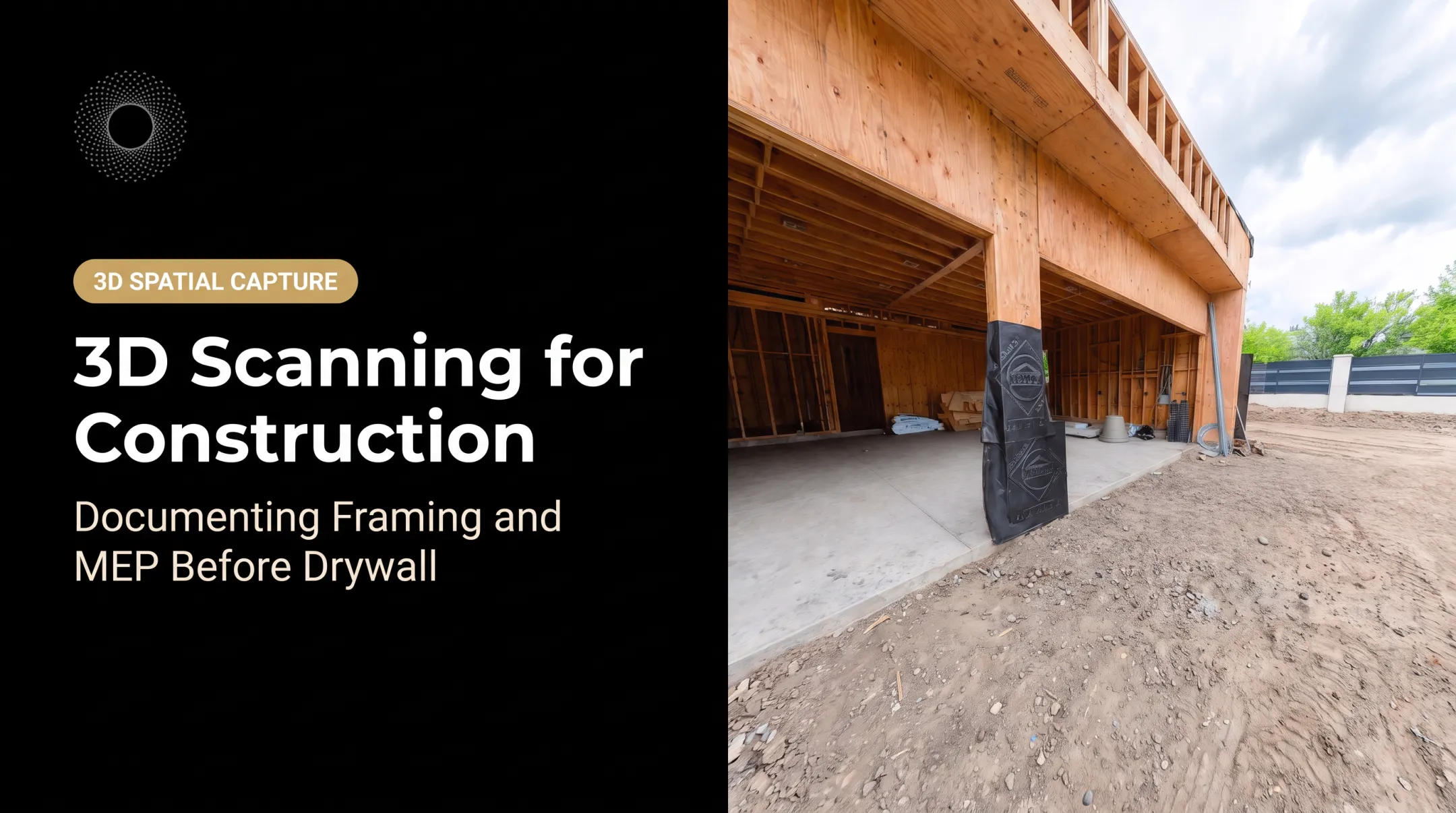
- The best scan happens after rough-in is installed and before finishes hide it.
- A solid workflow covers prep, capture, registration, quality control, and delivery.
- Scans support coordination and records, but don't replace surveys or BIM models.
What Is Lidar Scanning for Construction?
Lidar (Light Detection and Ranging) is a non-contact method that measures distance with laser light. Pulses reflect off surfaces, and round-trip time gives distance. Each measurement becomes an XYZ point, and together the points form a point cloud of the building.

What it does and doesn't do
It fills a real gap. Notes, photos, and 2D drawings may not preserve the exact position and relationships of rough-in work once walls close.
It has limits, too:
- It does not see through drywall. It records only visible surfaces.
- It doesn't automatically produce a coordinated BIM model.
- It isn't a legal certification or a penetrating inspection.
Choosing a scanning approach
- Stationary terrestrial: tripod-based setups for detailed interiors.
- Mobile or handheld: walking captures; longer open routes raise drift risk.
- Aerial: aircraft-based, suited to broad exterior areas.
- Device-based: tablet-class scanners with short range. Apple's 2020 iPad Pro, for example, specifies up to 5 meters.
Project size, indoor or outdoor conditions, required detail, range, and the intended deliverable drive the choice.
How Does Lidar Scanning Capture a Job Site Before Close-In?
The workflow runs from planning to capture, alignment, checks, deliverables, and a documented handoff. Vroomk's process follows the same arc: capture the full space, then turn it into a shareable digital record.
Site Preparation and Capture Timing
Agree on the window with the project team. The target: framing and MEP rough-in installed, inspected as needed, and still exposed.
Before the visit, confirm:
- Room list and areas that need repeat scans
- Trade coordination so nobody is mid-install in the shot
- Safety access for the scan crew
- Control points and required viewpoints
Scanning from one position leaves shadows behind walls, equipment, and columns. Plan overlapping positions around obstructions.
Laser Capture and Point-Cloud Creation
The scanner emits pulses, times the returns, combines distance with angle, and records surface geometry as a dense cloud. Resolution, range, field of view, and line of sight decide whether you can pick out a conduit run or a sleeve.

Speed varies by setting. One Leica RTC360 sheet lists a full-dome scan with imagery in under two minutes at 6 mm spacing at 10 m. That's one setting, not a job duration.
Geometry alone can't show labels or material details. Add photos or annotations where they matter.
Scan Registration and Coordinate Alignment
Registration aligns multiple scan positions into one cloud using shared features, targets, or software methods. It matters when you trace a route across rooms, compare capture dates, or overlay drawings.
Georeferencing is separate. It places the cloud against known survey coordinates. Whether you need it depends on the project and downstream use.
Quality Control Before the Site Is Closed
Check before crews cover anything:
- Coverage gaps and occluded areas
- Alignment and drift
- Moving objects or wrong scan positions
- Insufficient detail
Surface type matters as well. Leica's manual flags polished metal, glossy paint, very dark surfaces, and clear glass as difficult, and notes that direct sun and weather add noise. Rescan or add photos when a critical area looks doubtful.
Record capture dates, locations, scan settings, control information, known limitations, and reviewer sign-off. Without that, the record confuses people later.
Processing, Deliverables, and Handoff
Teams clean and register raw scans, and sometimes colorize or annotate them. Outputs include point clouds, measurements, floor plans, walkthroughs, CAD references, or BIM inputs.
These are different products. A point cloud, a digital twin, an as-built drawing, and a coordinated BIM model each need different processing and review. As Trimble's scan-to-BIM guide explains, modeling comes after registration.
Vroomk offers interactive 3D spatial documentation with measurable captured spaces, exported imagery, and private shareable links. Stakeholders can review a condition remotely. Vroomk doesn't present this as a certified survey or a LiDAR-specific service.
Where Lidar Scanning Fits Before and After Close-In
Before Drywall or Ceiling Close-In
A scan preserves the visible location of wiring, conduit, plumbing, ductwork, framing, sleeves, valves, and junctions. A remodeling customer of Vroomk opened a rough-in scan, found every wiring run, and avoided cutting finished drywall. Field verification still comes before any cut.
MEP Coordination and Quality Review
Teams compare captured conditions with design intent, spot apparent conflicts, and coordinate electrical, plumbing, HVAC, and framing. The capture supports those decisions without replacing inspections, engineering judgment, or project tolerances.
Progress Monitoring and As-Built Records
Scans at set milestones build a measurable history of what was installed and what changed. Downstream uses include:
- Comparison against drawings or models
- Deviation review
- Owner handoff and maintenance planning
- Future renovation
One Vroomk user scans before drywall and at each milestone, and the rough-in stays in the record after the walls close.

Claims, Insurance, and Dispute Coordination
Dated, organized records help contractors, owners, adjusters, restoration professionals, and defect attorneys discuss pre-existing conditions, concealed work, and scope changes. Admissibility isn't guaranteed: Federal Rules 901 and 702 set authentication and expert-evidence conditions, and no record is automatically immutable.
Renovation, Maintenance, and Future Service Work
A pre-close-in record cuts uncertainty during repairs, additions, and inspections. Supplement it when the question demands more:
- Photos and written notes for labels and context
- Thermal imaging for moisture patterns
- Utility locating for buried lines
- Selective demolition for concealed conditions
- A licensed survey where one is required
Conclusion
The logic is simple. Plan the capture window while critical work is exposed, scan from enough viewpoints, align and verify the data, then deliver a clearly labeled record.
Done well, it preserves context for coordination, future access, claims review, and maintenance. Just don't mistake it for a complete BIM model, a certified survey, or a view through finished surfaces.
Frequently Asked Questions
How much does lidar scanning for construction cost?
Price depends on site size, scan positions, required detail, capture frequency, travel, processing, and deliverable type. Providers often quote case by case. Vroomk's spatial capture starts at $1.50 per square foot.
What is lidar scanning in construction?
It's laser-based spatial measurement that builds a point cloud. Teams use it to document existing or in-progress conditions.
Can you lidar scan a building?
Yes, indoors and out, wherever surfaces are accessible. Line of sight and environmental conditions limit it, and it captures exposed conditions only, not what's inside walls.
Are ALS and lidar the same?
Not quite. Lidar is the broader distance-measuring technology. ALS is airborne laser scanning, lidar collected from an aircraft or other airborne platform.
What should be scanned before drywall is installed?
Exposed MEP routes, framing, penetrations, equipment, access points, room geometry, and areas likely to be drilled later. Project requirements set the final checklist.
How accurate is lidar scanning for construction sites?
It depends on the scanner, range, setup, registration, control, surfaces, and processing. For example, the Leica RTC360 lists 1.9 mm 3D point accuracy at 10 m under stated conditions. Check the specifications for your equipment and use.